Current Project
The investigation of the Polish archaeological mission in Khirbat as-Sar in 2018 and 2019, conducted on behalf of the PCMA, ended due to the Coronavirus-19 pandemic. A new research project enabling the resumption of field research did not begin until 2022, this time on behalf of the Faculty of Archaeology, University of Warsaw, and with funding from the National Science Centre (UMO 2021/43/B/HS3/00813). So far, three seasons of excavations have taken place.
Season 2024
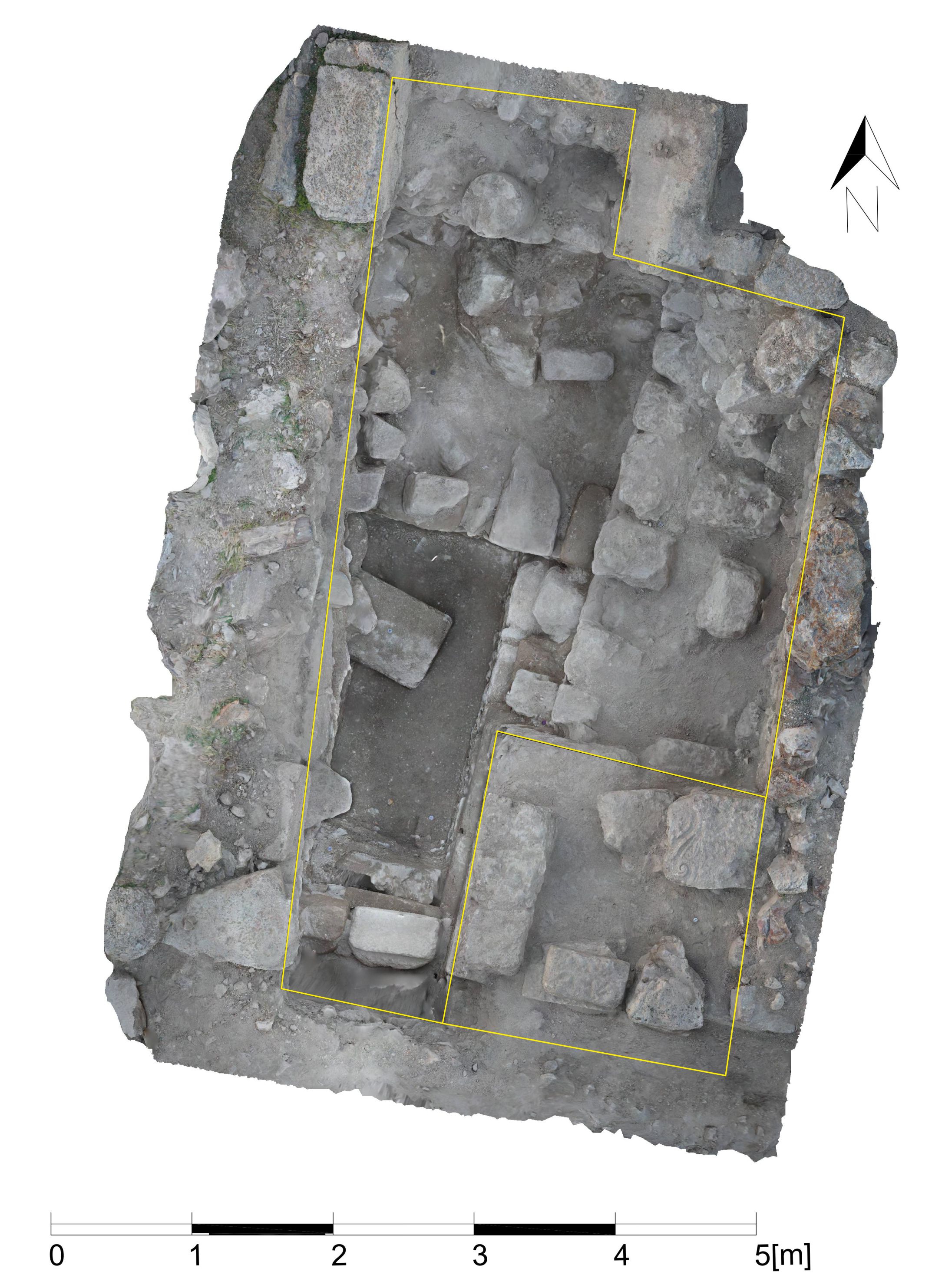
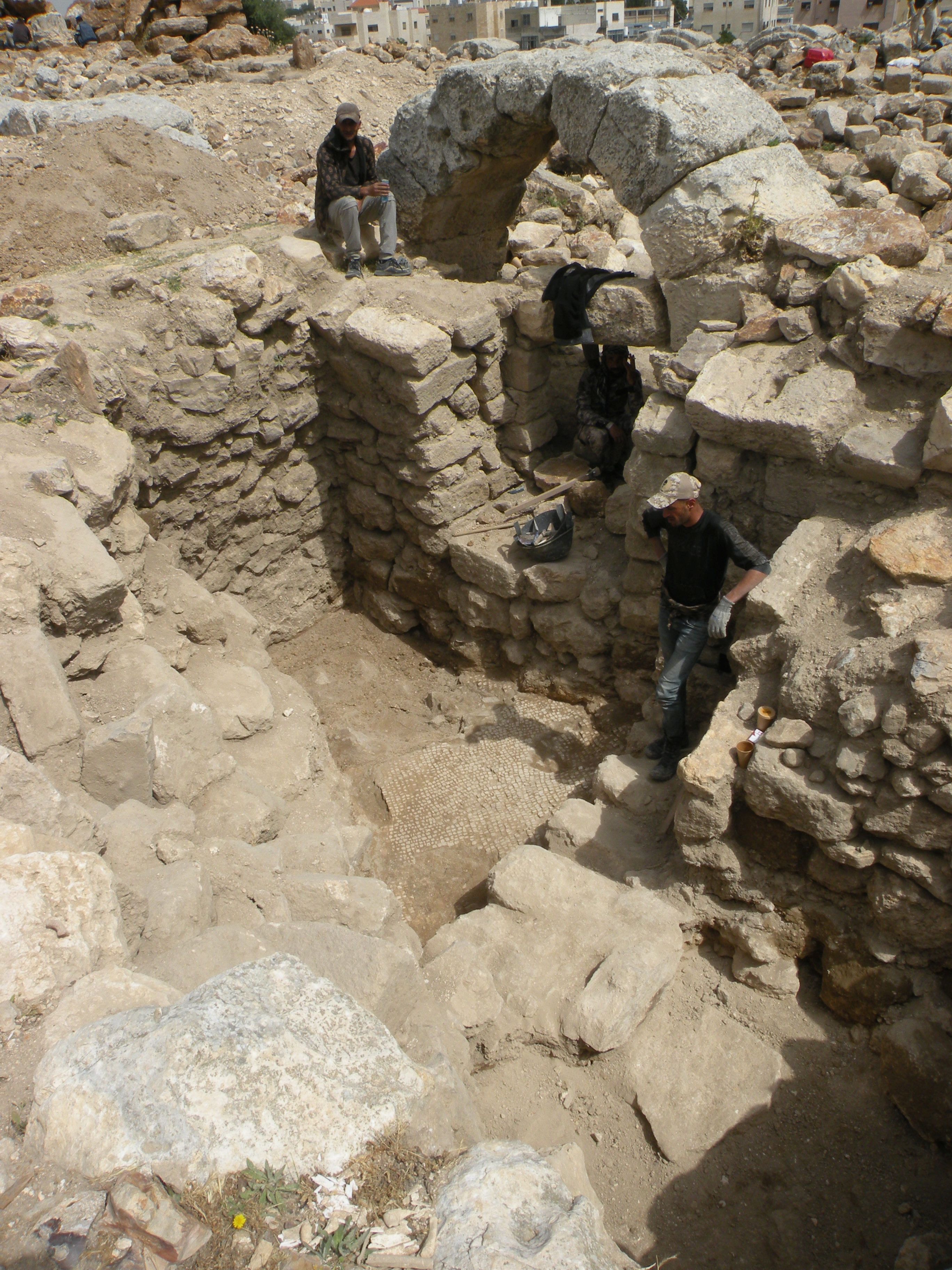
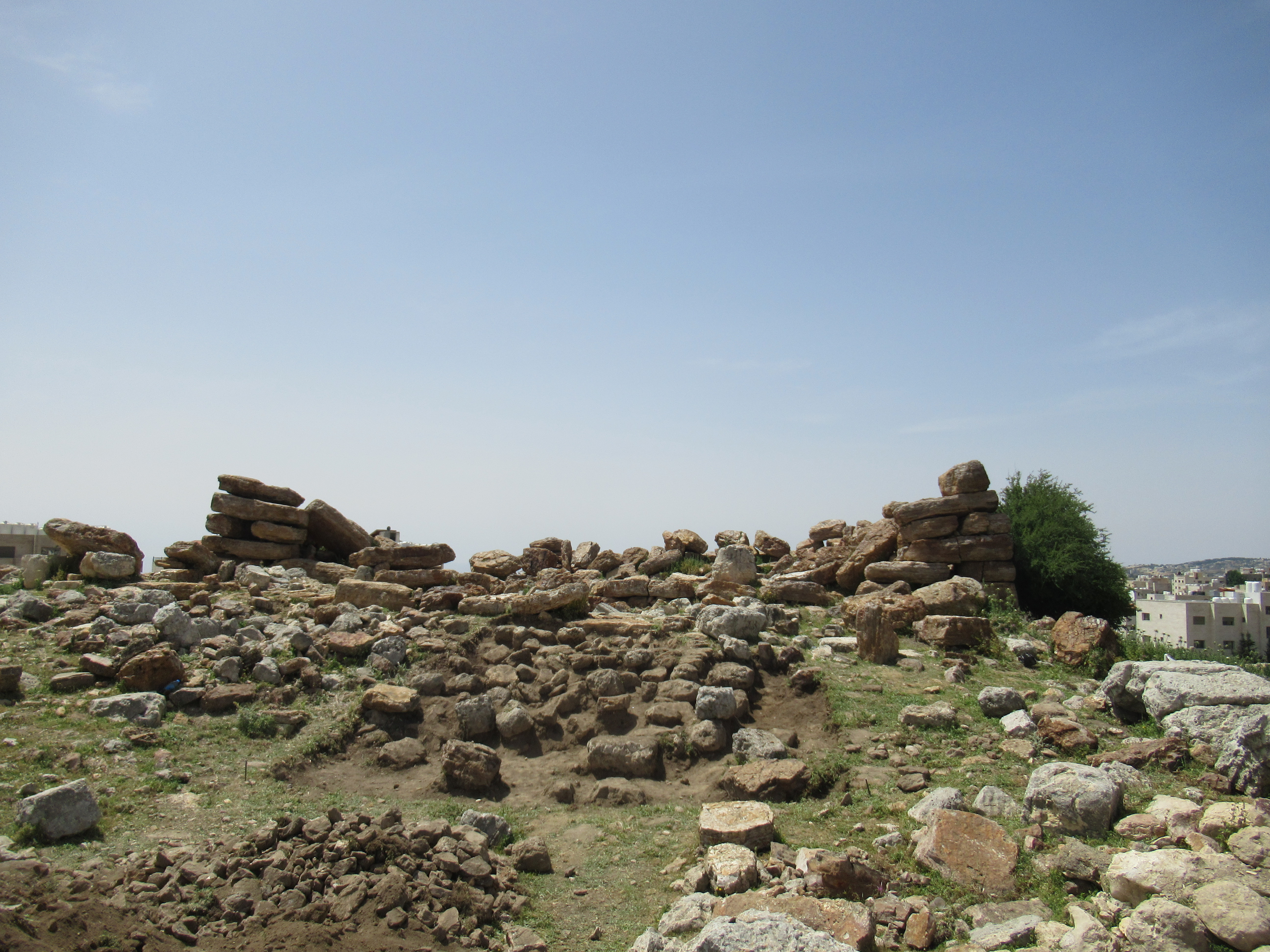
The second excavation season at the site of Khirbet as-Sar was conducted between 21 April and 18 May 2024 (Permit no. 8/2024). Two trenches (T1/3-W and T2-S) were opened in the eastern part of the courtyard of the architectural compound that had preliminarily been identified as a Roman period sanctuary. Topographically, they have been extensions of the trenches first explored in 2019 and subsequently enlarged in 2023. A new Trench (T5) was opened in front of the Roman-period addition (a vestibule?) on the eastern side of the "Ammonite tower" ().
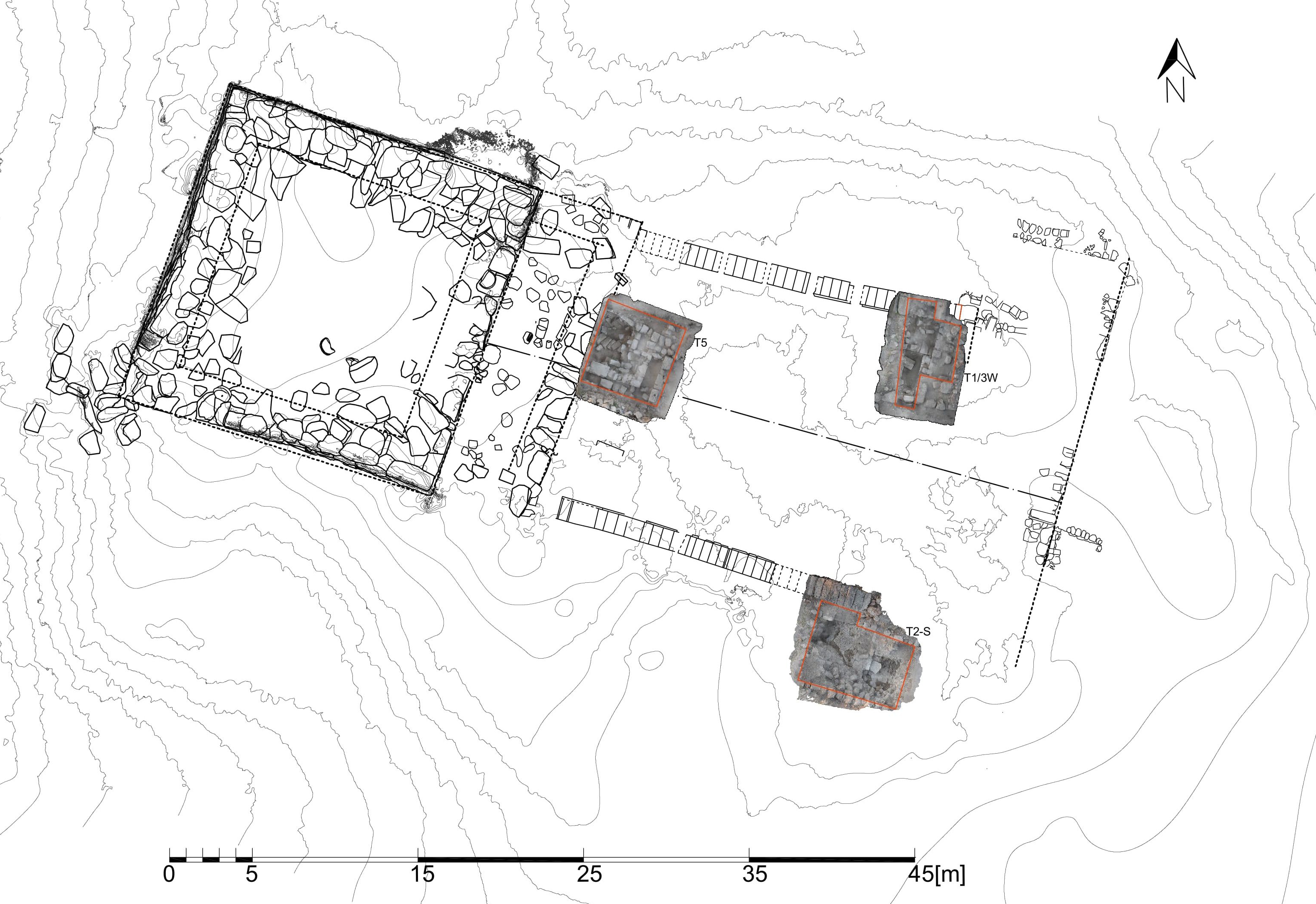
trenches (image by Anna Kubicka-Sowińska).
Trench T1/3-W
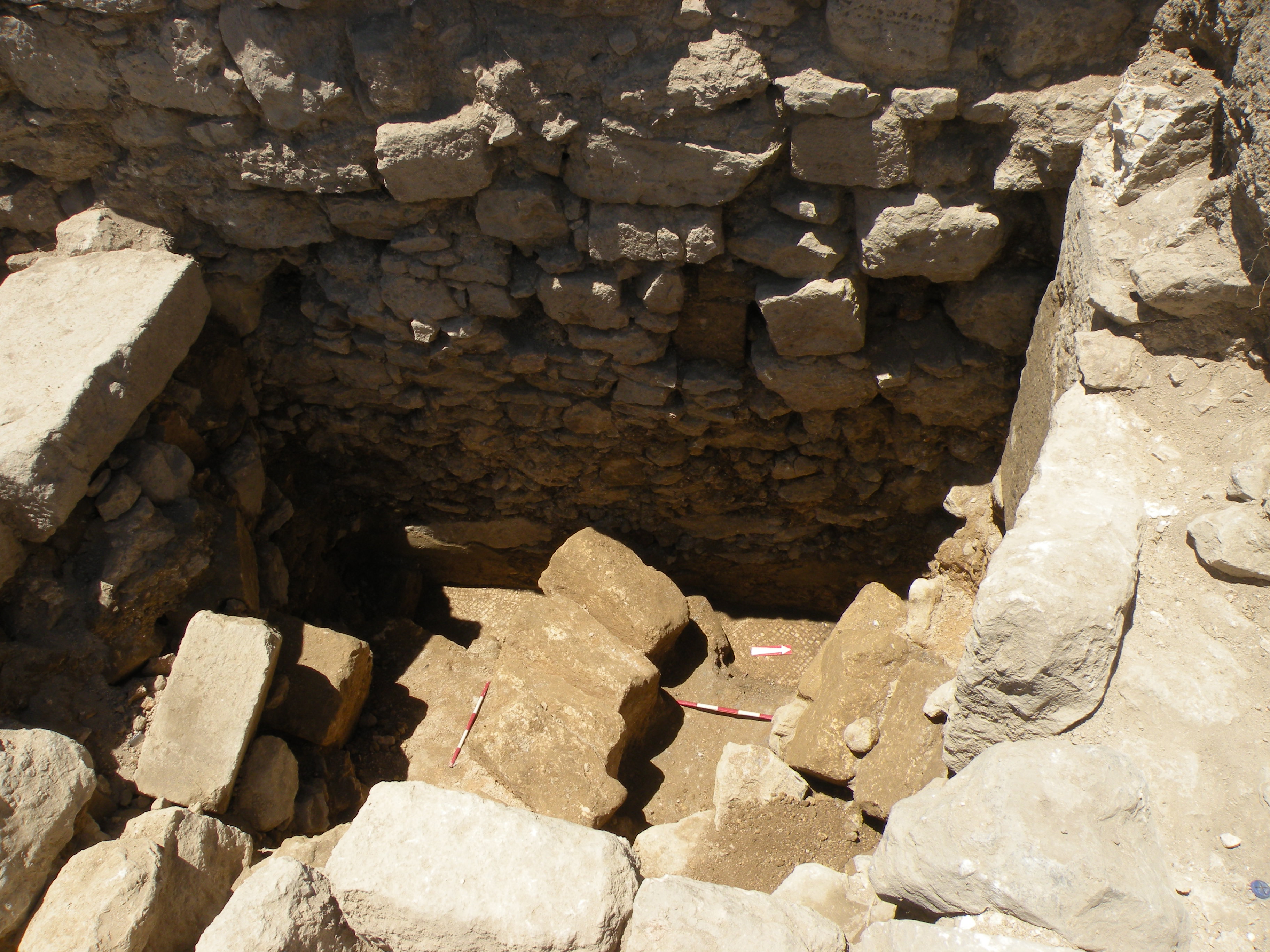
Trench T1/3-W is a western extension of Trench T1/3, excavated in 2023. Its exploration yielded evidence of a dense occupation during the Middle and Early Islamic period (already recorded in 2023 in T 1/3 right to the East).
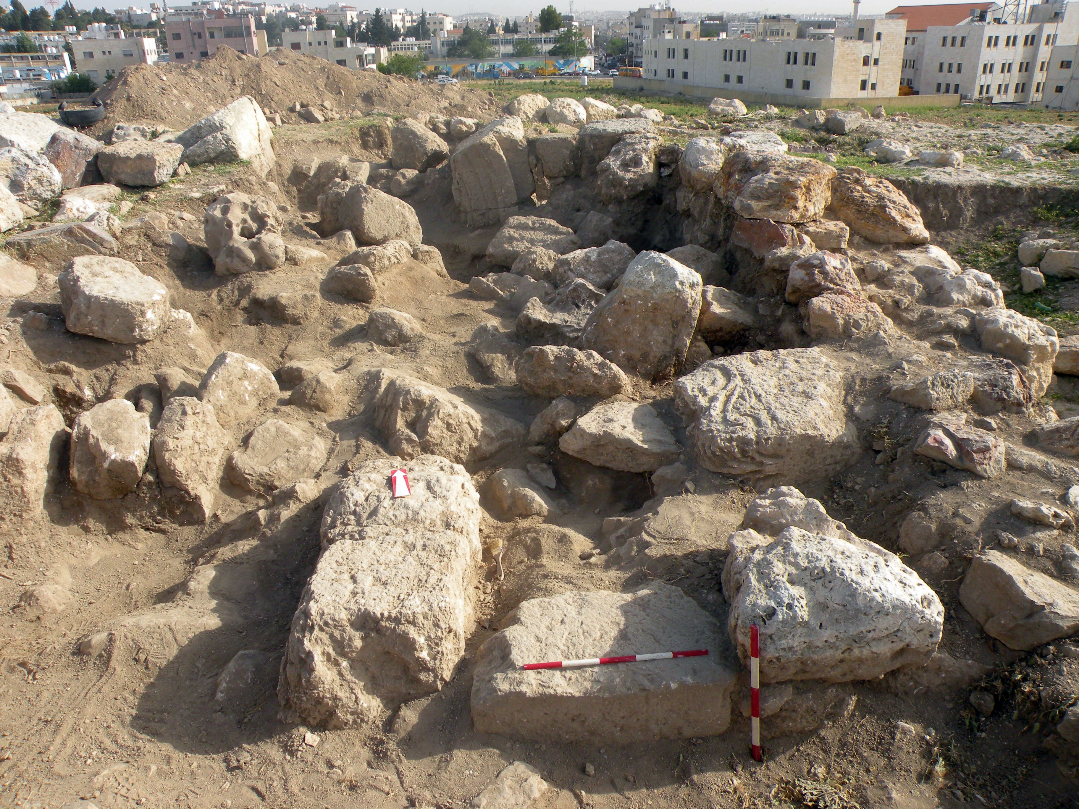
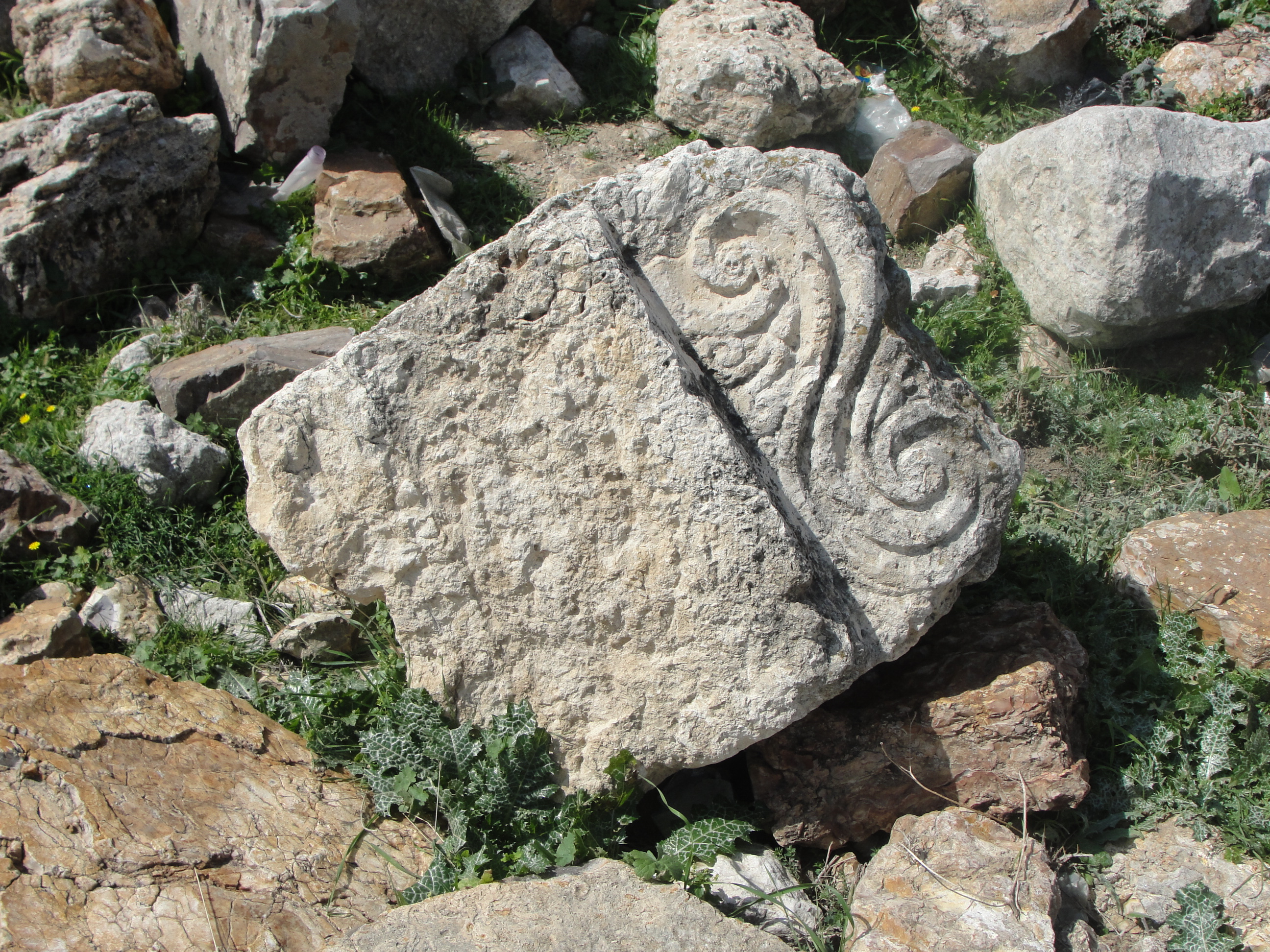
The top layer consisted of at least two layers of stone debris (), including spolia. The most remarkable was a monumental wall bracket that originated from an earlier structure (, ). Together with the bracket lying on the surface in the eastern part of the courtyard, it may have supported a lintel of a gate once leading into the sanctuary courtyard.
(image by Mariusz Burdajewicz).

reused in the top layer (image by Jolanta Młynarczyk).
courtyard (image by Mariusz Burdajewicz).
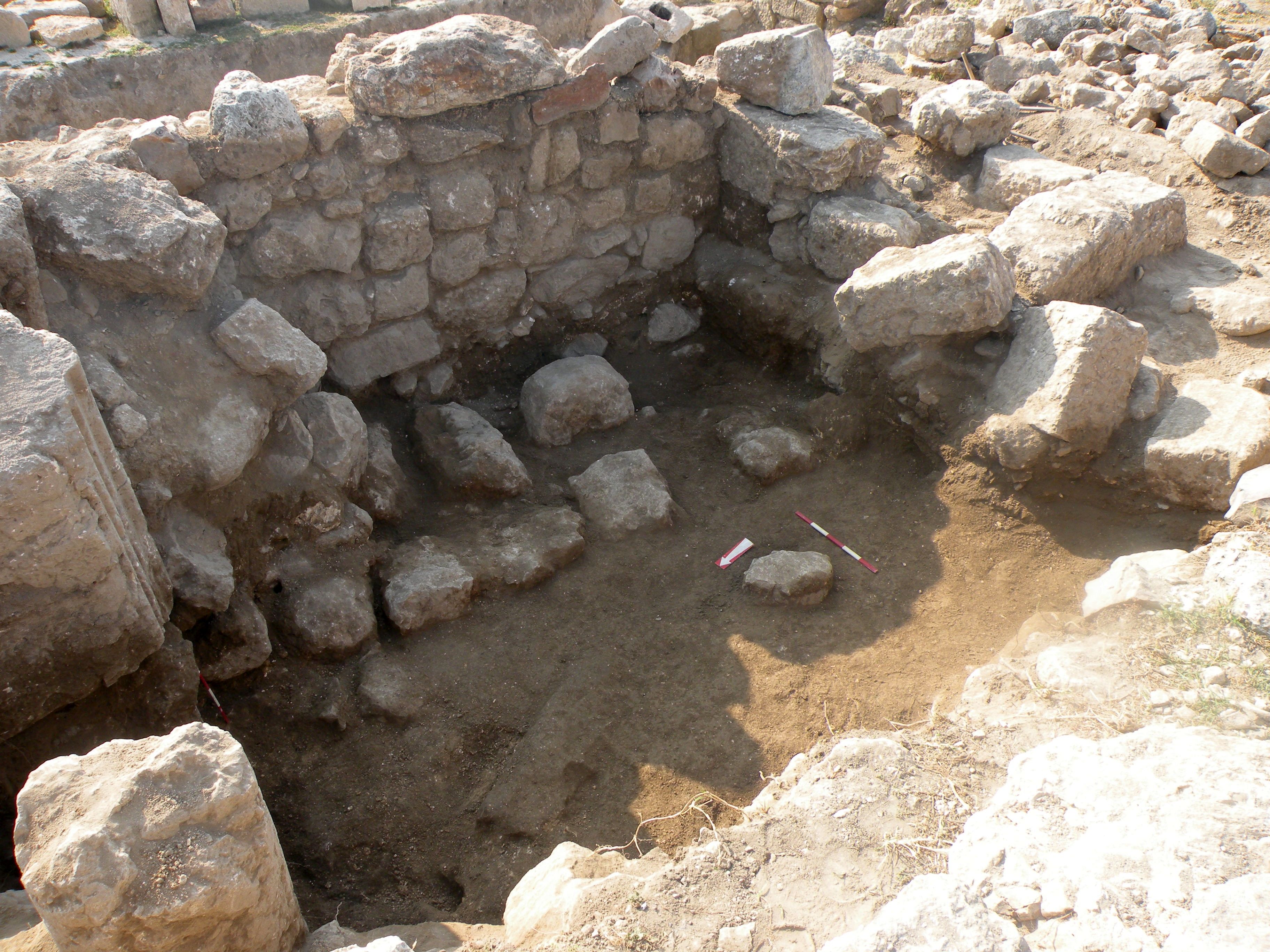
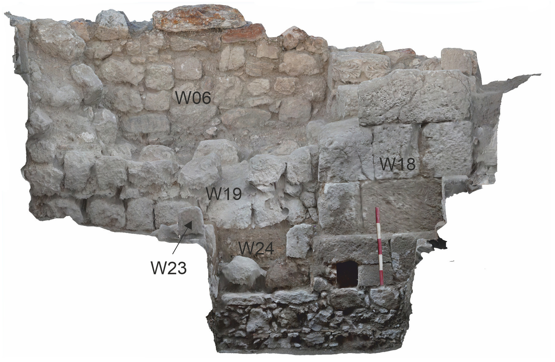
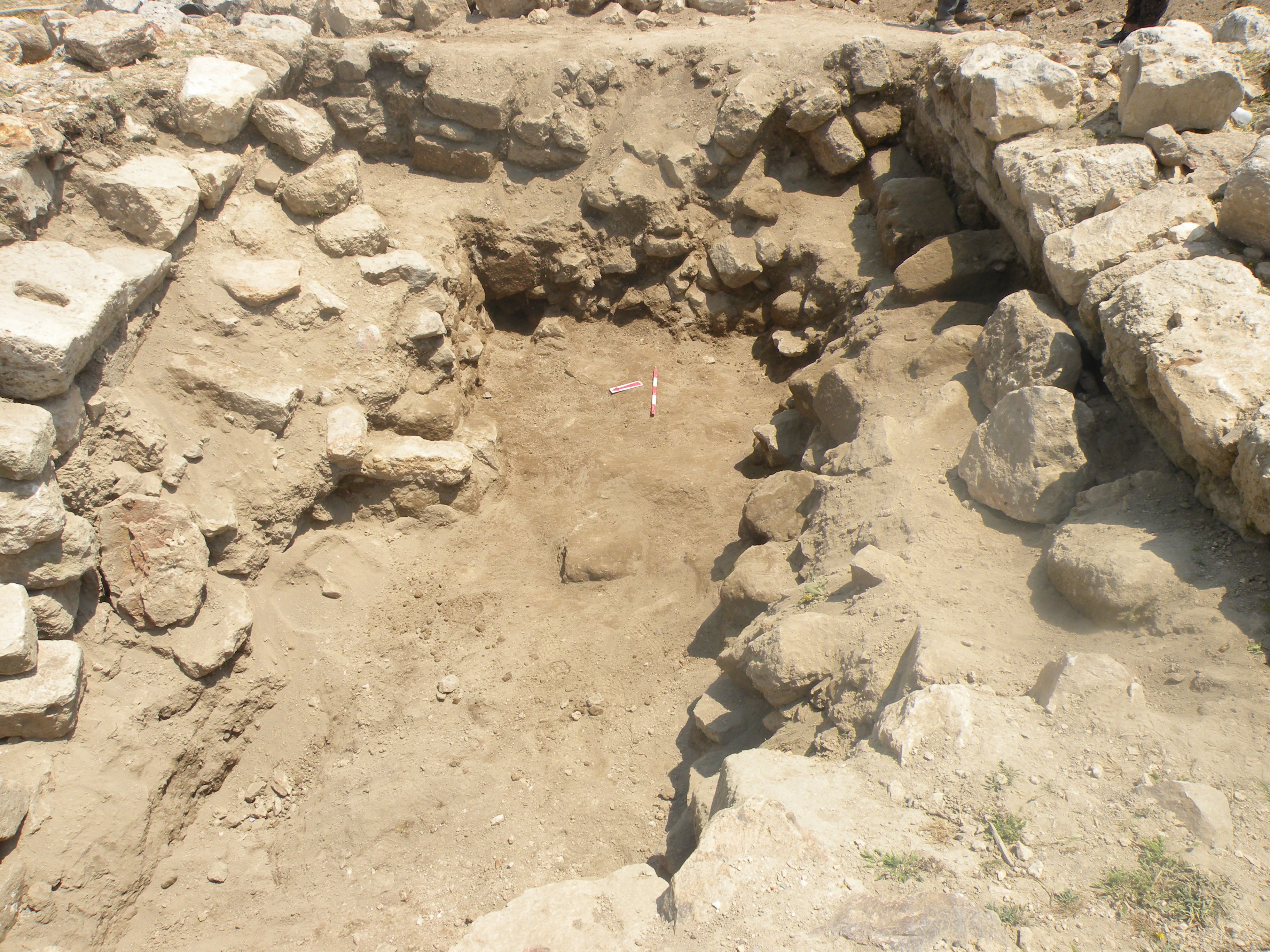
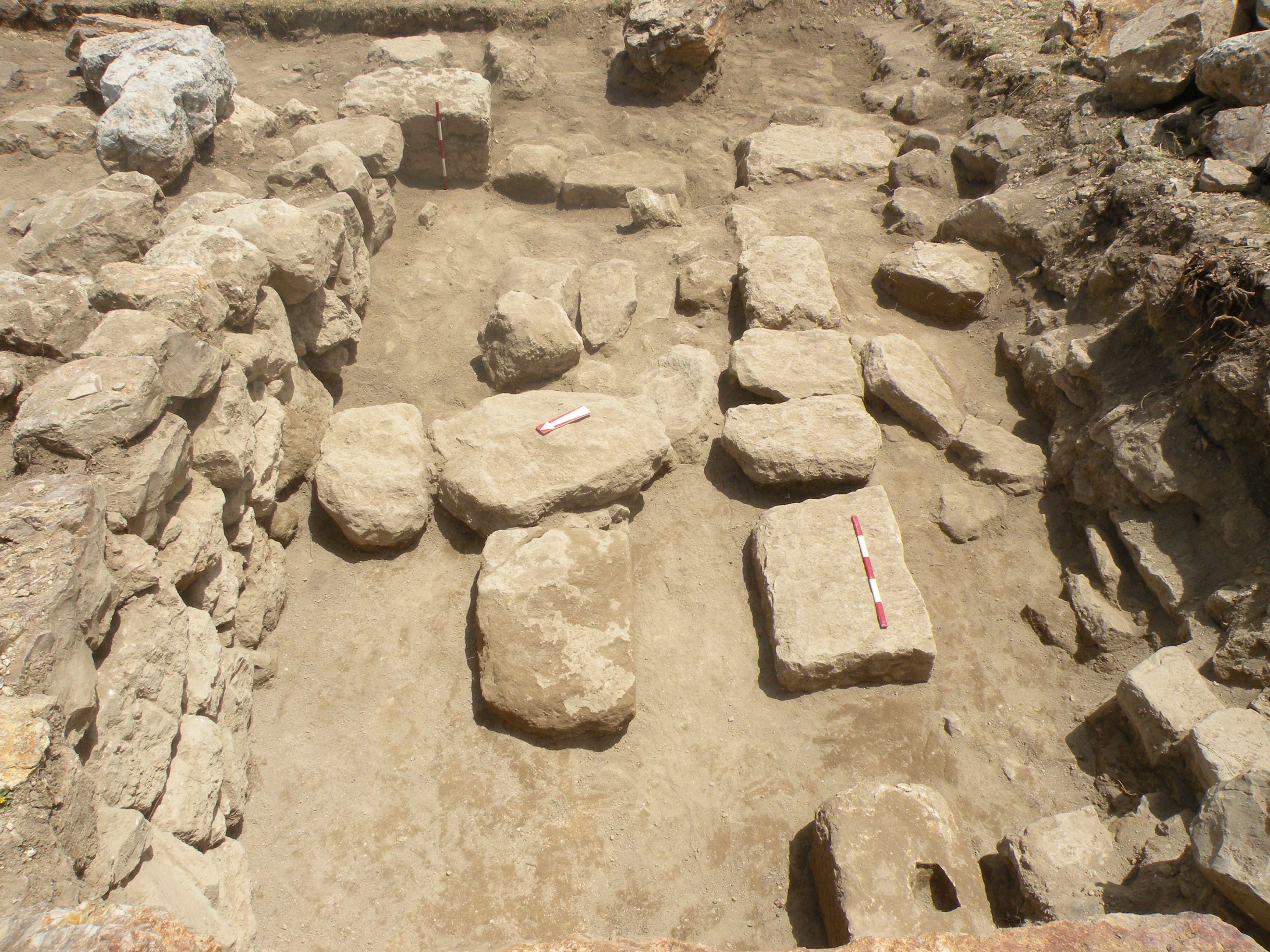
The latest occupation level consisted of a poor earthen floor, probably containing two consecutive phases with traces of fireplaces, dated by pottery to the Mamluk period. The northern limit of the room was a carelessly built wall W22 or rather a blockage, which included a column shaft set in the space of the damaged easternmost arch of the northern arcade of the Roman courtyard. The eastern limit of the room was W06, a division wall between T 1/3-W and T 1/3. The entrance to the room was on the South, between W18 and W20 ().
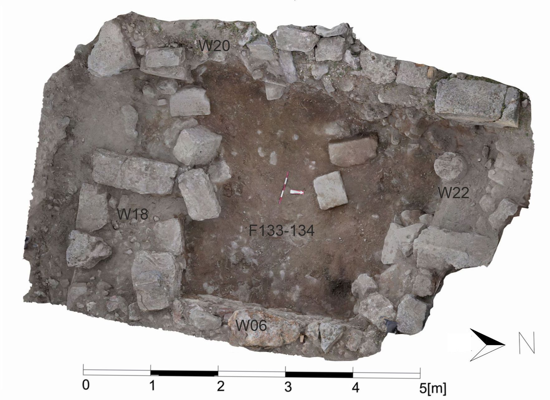
(orthophoto by Adel Wojtek Oubraham).
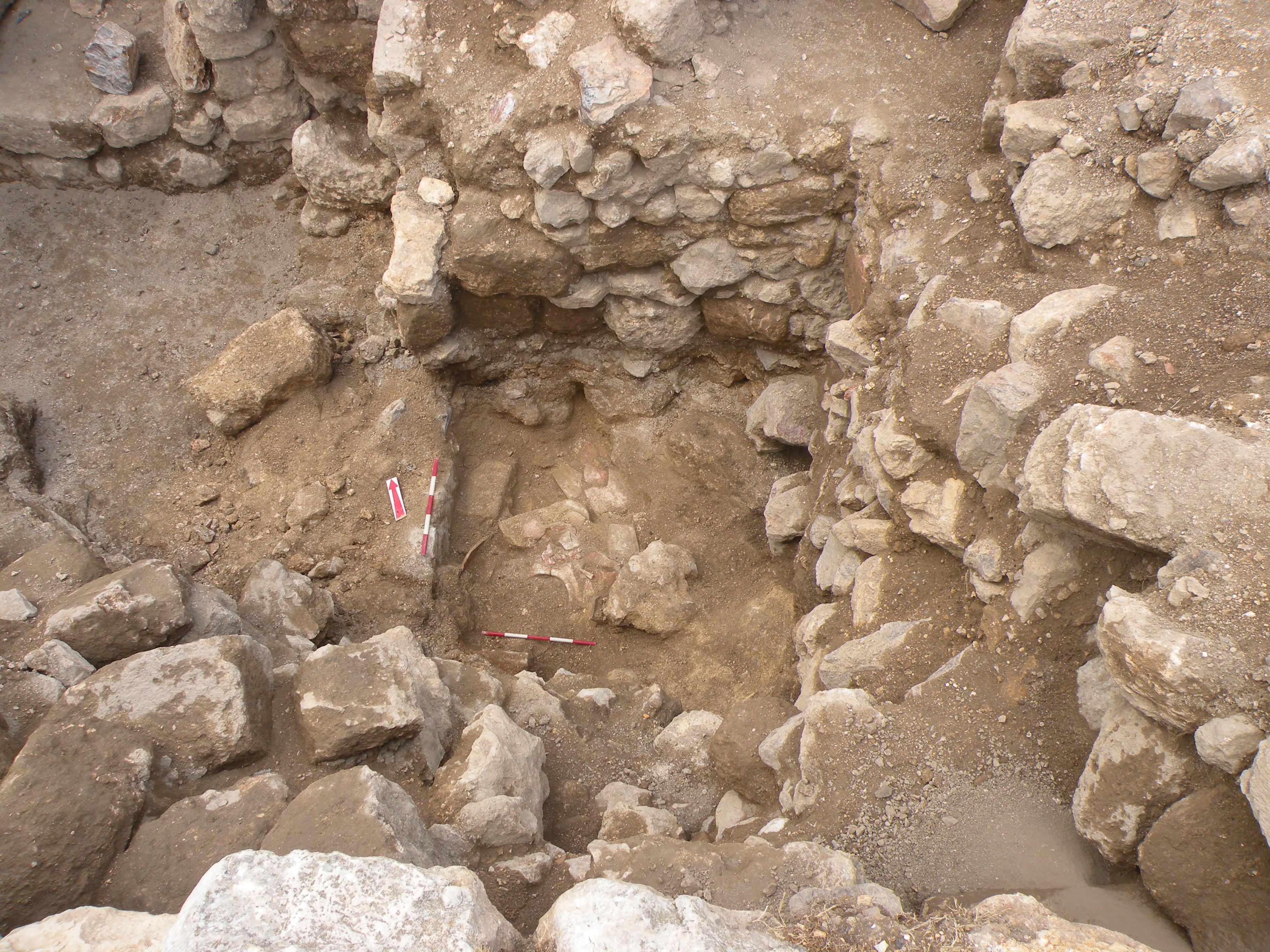
The earlier occupation phases are represented by a sequence of walls, floors, and layers of rubble, accompanied by fireplaces, burnt pieces of a tabun, and sparse pottery dated successively to the Ayyubid, Abbasid/Fatimid, Abbasid, and Umayyad periods (, , ). Interestingly, the Middle Islamic occupational levels yielded relatively little ceramics; instead, the remains of metal (iron?) slag and finds of horseshoe nails have been suggestive of the activity of a blacksmith workshop. Metal smelting was also present in the Early Islamic period, with the architectural remains sitting directly on top of those from the Roman period.
(image by Mariusz Burdajewicz).

top of a wall constructed of spolia,
with Abbasid/Fatimid (?) period
floor in the foreground; view from
the South (image by Mariusz
Burdajewicz).
W18 (left) with a makeshift wall
(blockage?) upon the Umayyad
period floor in the background;
view from the North (image by
Mariusz Burdajewicz).
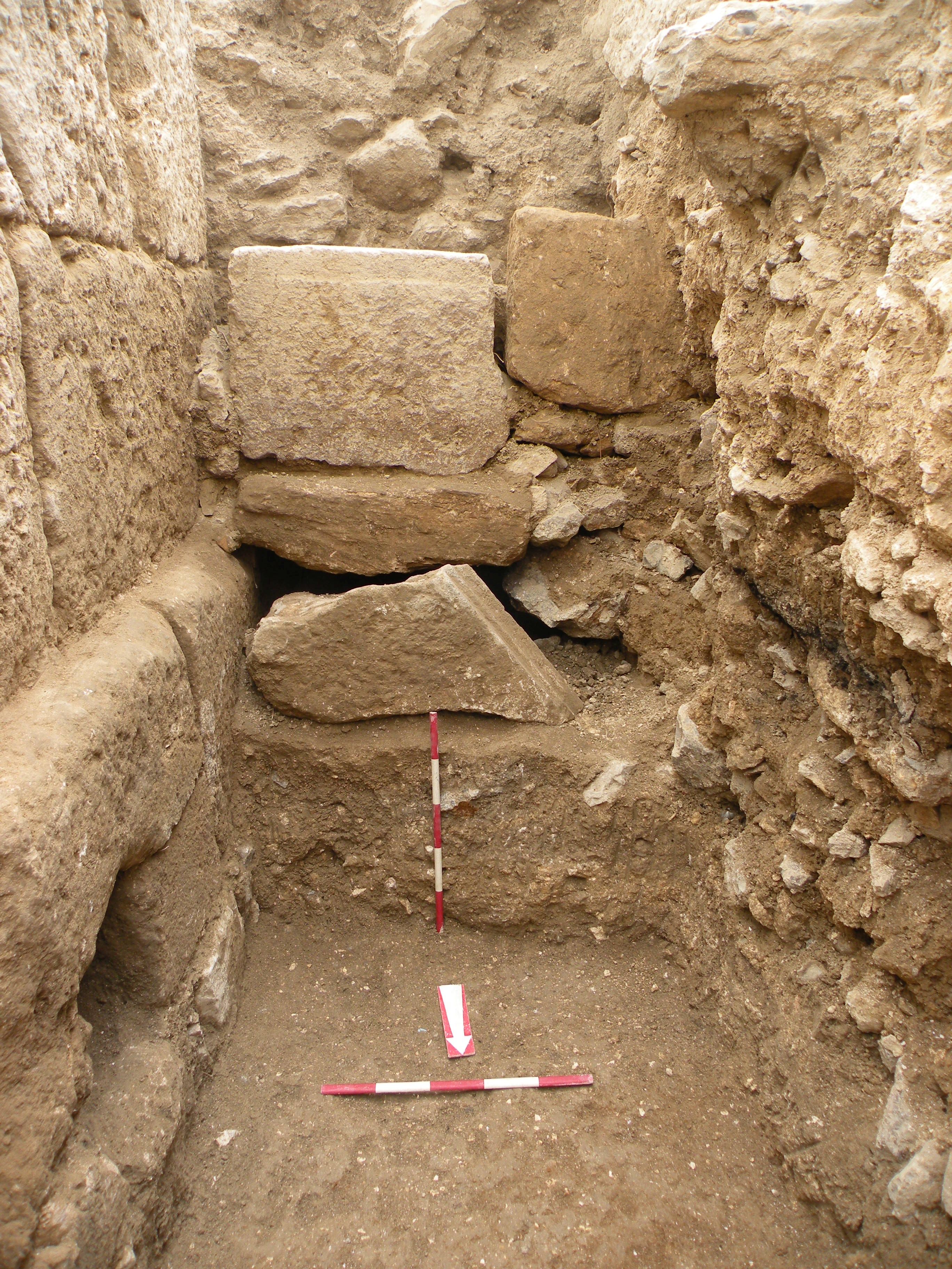
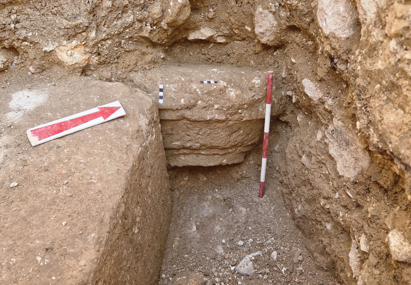
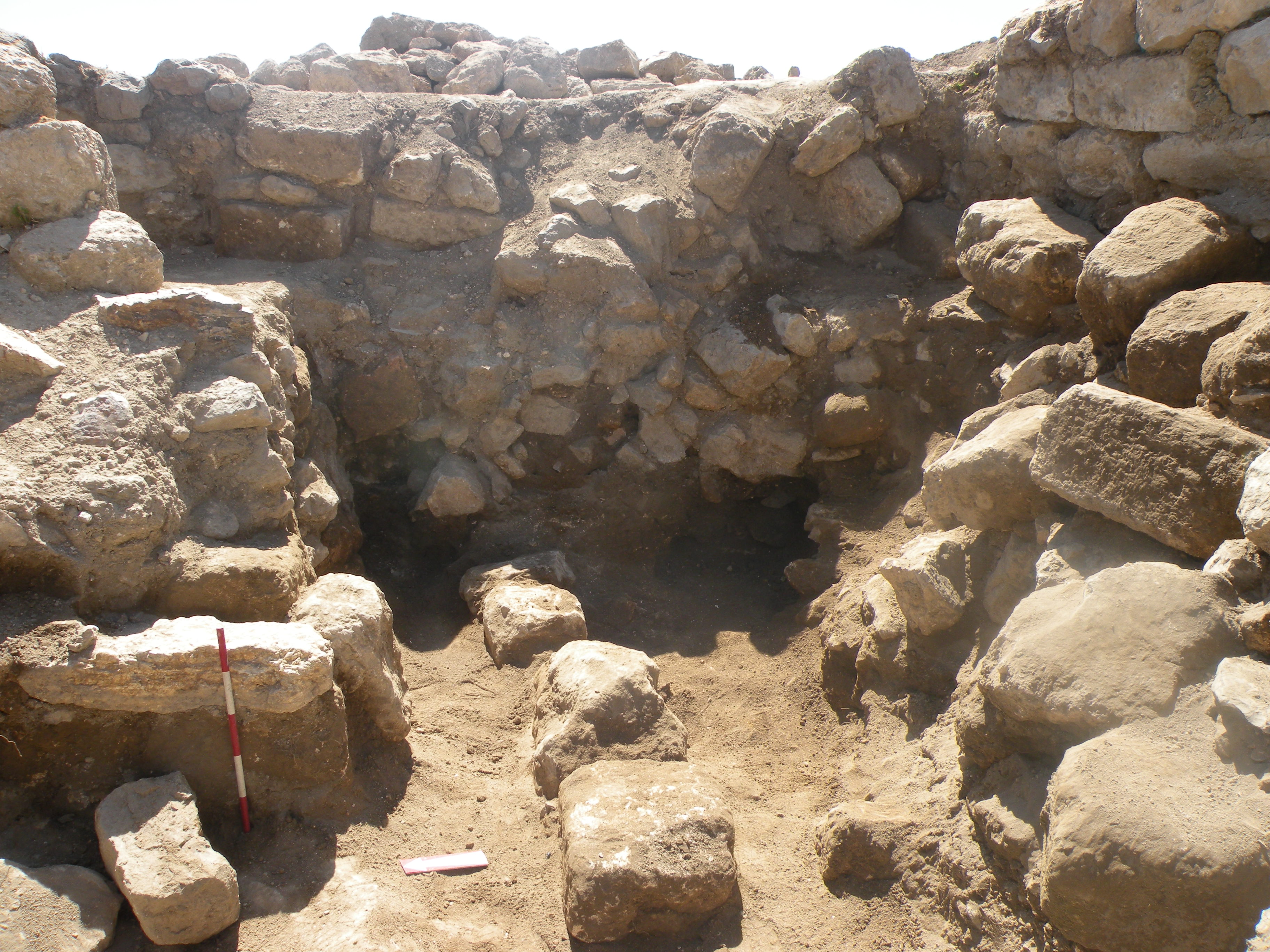
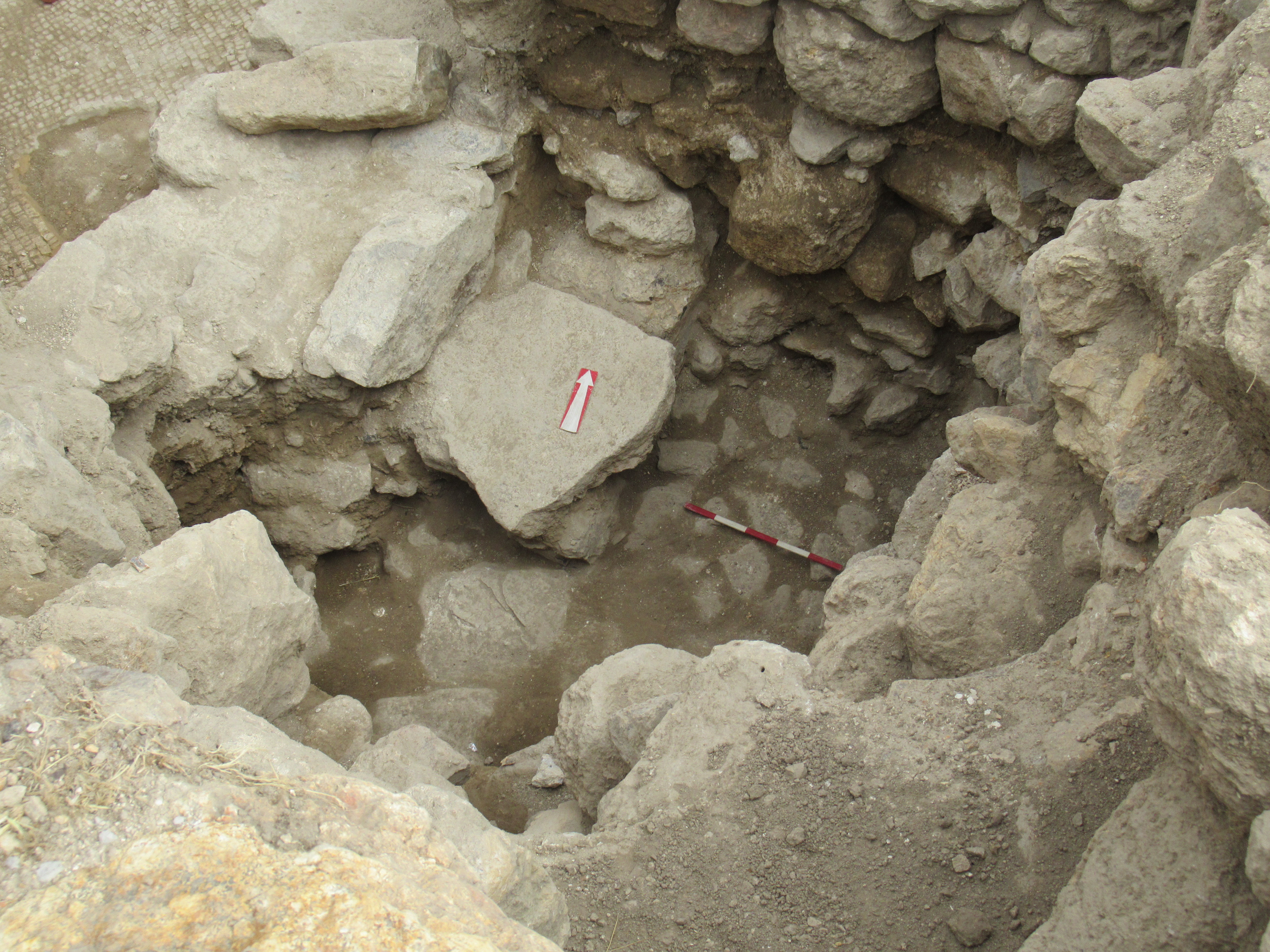
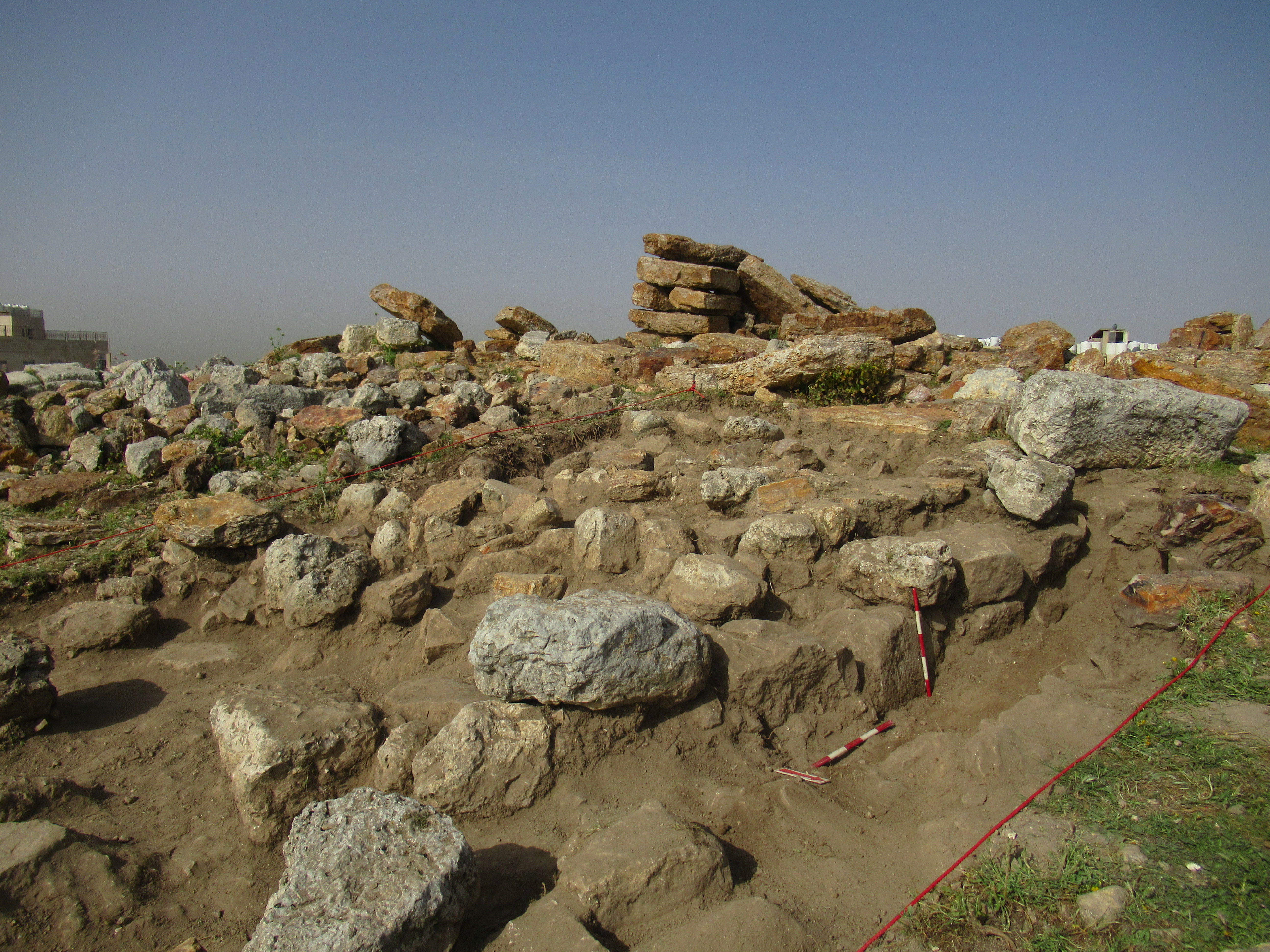
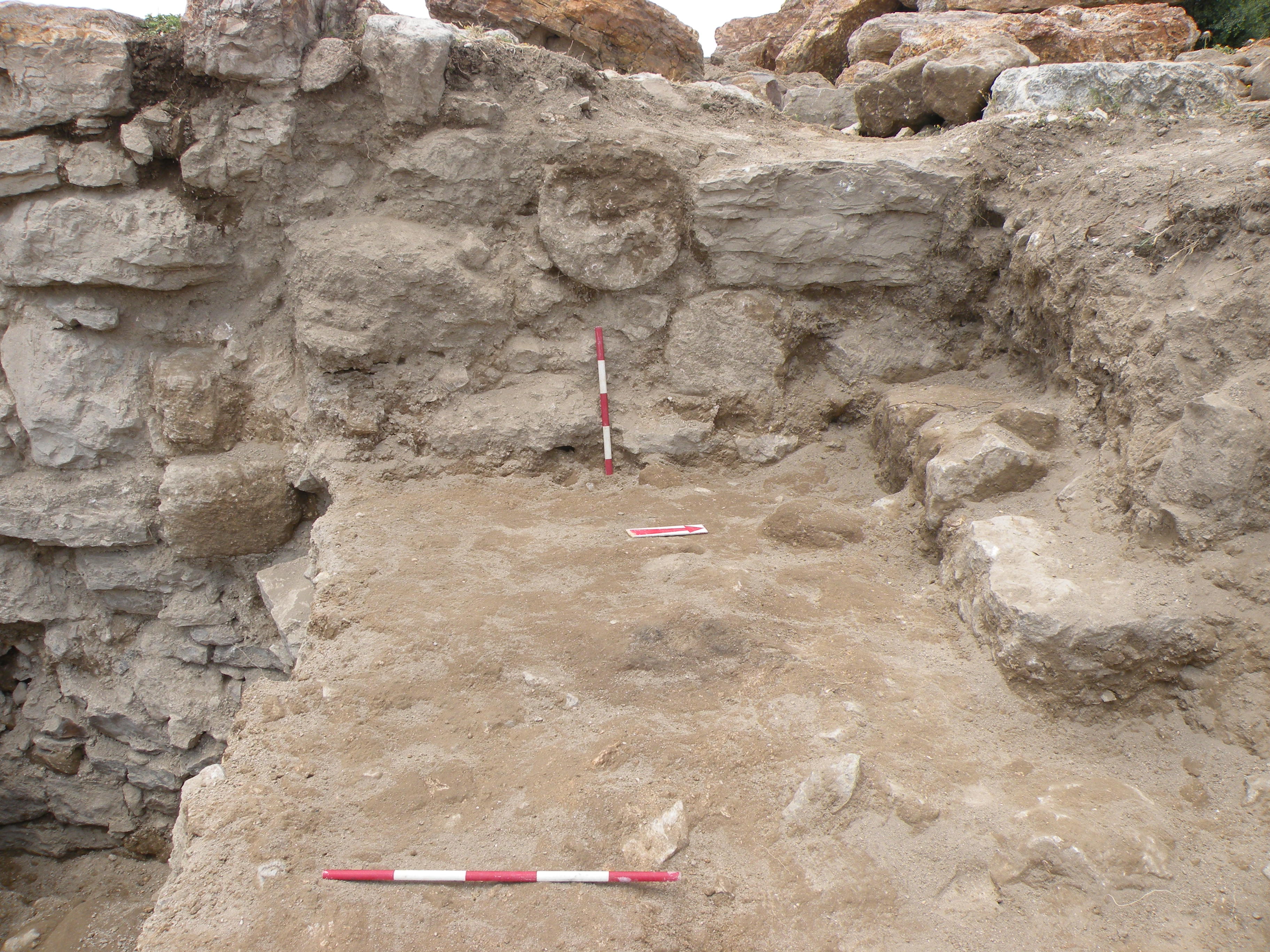
Indeed, a mighty pillar, rectangular in plan (c. 2m x 1.80m) and built of big carefully dressed limestone blocks, is a Roman-period construction still used well into the Mamluk period (, ), when its top was completed with reused architectural elements. Below the offset of the pillar, there is a square opening (c. 0.20 x 0.20m), probably a drain (sewage?) that would evacuate rainwater(?) towards the East. The drain was doubtlessly associated with floor F146, the lowest floor reached in the Trench (). This fact strongly suggests that the space to the West of it was initially an open-air passage(?). Only during the next (Umayyad-period?) phase was the passage(?) blocked.

by Mariusz Burdajewicz).
topped by W19; Mamluk wall W06 in the background above W19
(image by Adel Wojtek Oubraham).

F146 with the opening of a channel
/drain in W18; view from the
Northwest (image by Mariusz
Burdajewicz).
Very profound foundations of the pillar, the bottom of which could not have been reached during this season, are associated with a thick leveling layer that contains early Roman and Hellenistic material. The material in question is not only ceramics, covering the period between the late 2nd century BCE and 1st century CE, but also a colossal upright-standing block of limestone, comparable to the masonry of Iraq el-Amir, and a column capital of limestone, deeply stuck in the western profile of the Trench. It can be described as one of the Palestinian versions of the Doric capitals of the late Hellenistic period ().
in the western profile of the Trench, in the leveling layer below floor
F146 (image by Karolina Warecka).
To conclude the exploration of Trench 1/3-W (), the phasing of architectural features and habitation levels can preliminarily be established as follows:
- Mamluk-period phase (mid-13th - 15th century)
- Ayyubid period (late 12th - mid-13th century)
- Abbasid-Fatimid period (8th/9th - 11th-12th century)
- Umayyad period (7th - mid-8th century)
- late(?) Roman period (4th-5th century, or perhaps earlier)
Trench 2-S
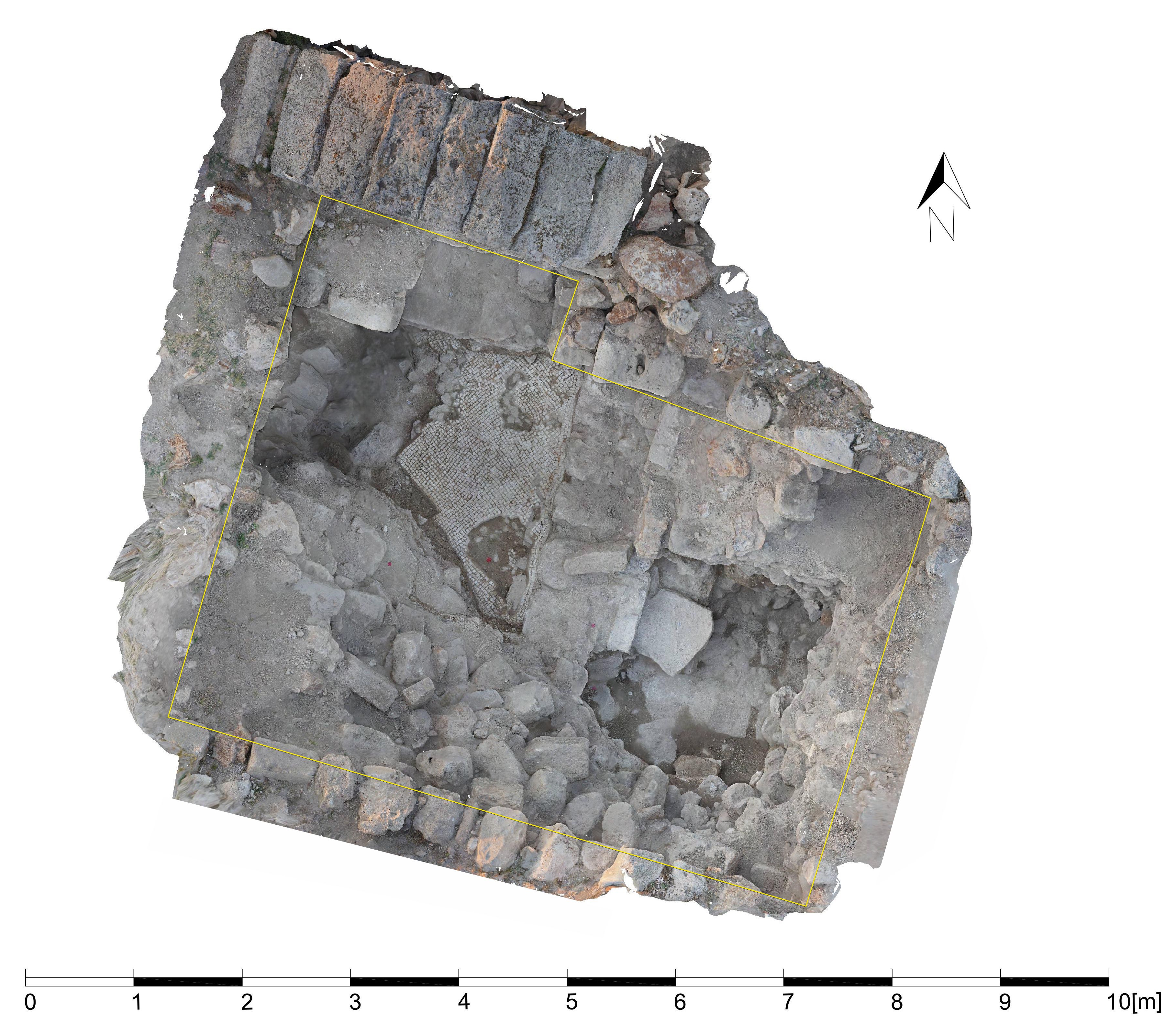
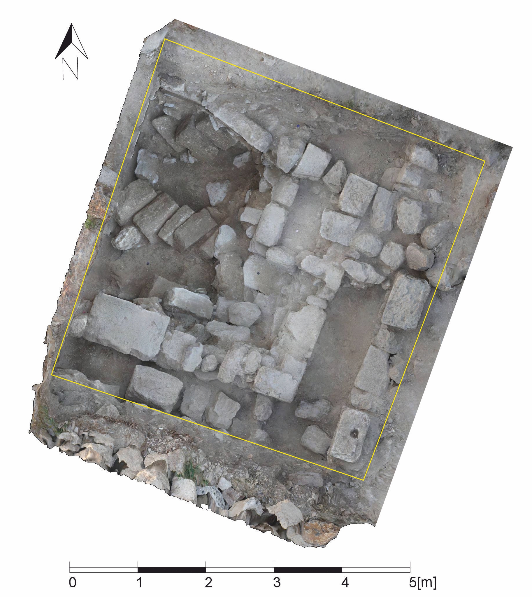
Archaeological exploration was resumed in Trench 2-S right to the South of the Roman-period arch (see ), the northern side of which (Trench 2) had been excavated down to the original level of the Roman courtyard in 2019. The work undertaken in Trench T2-S in 2023 had to be interrupted due to the dense collapse of stone building material (blocks and boulders), which rendered the examination of the stratigraphy virtually impossible. However, the excavations in the current season allowed us to determine the sequence of walls and floors, of which the latest floor has been dated by potsherds to not earlier than the 13th/14th century CE ( and ). It was preceded by a habitation level apparently of the Ayyubid period (early Mamluk?) period ( and ), during which the barrel vault of the room may have been constructed. Only the North-South extent of the room, equal to the width of the barrel vault, could be defined as c. 4.20m.
vaulted room; view from the West (image by Mariusz
Burdajewicz).
(image by Mariusz Burdajewicz).
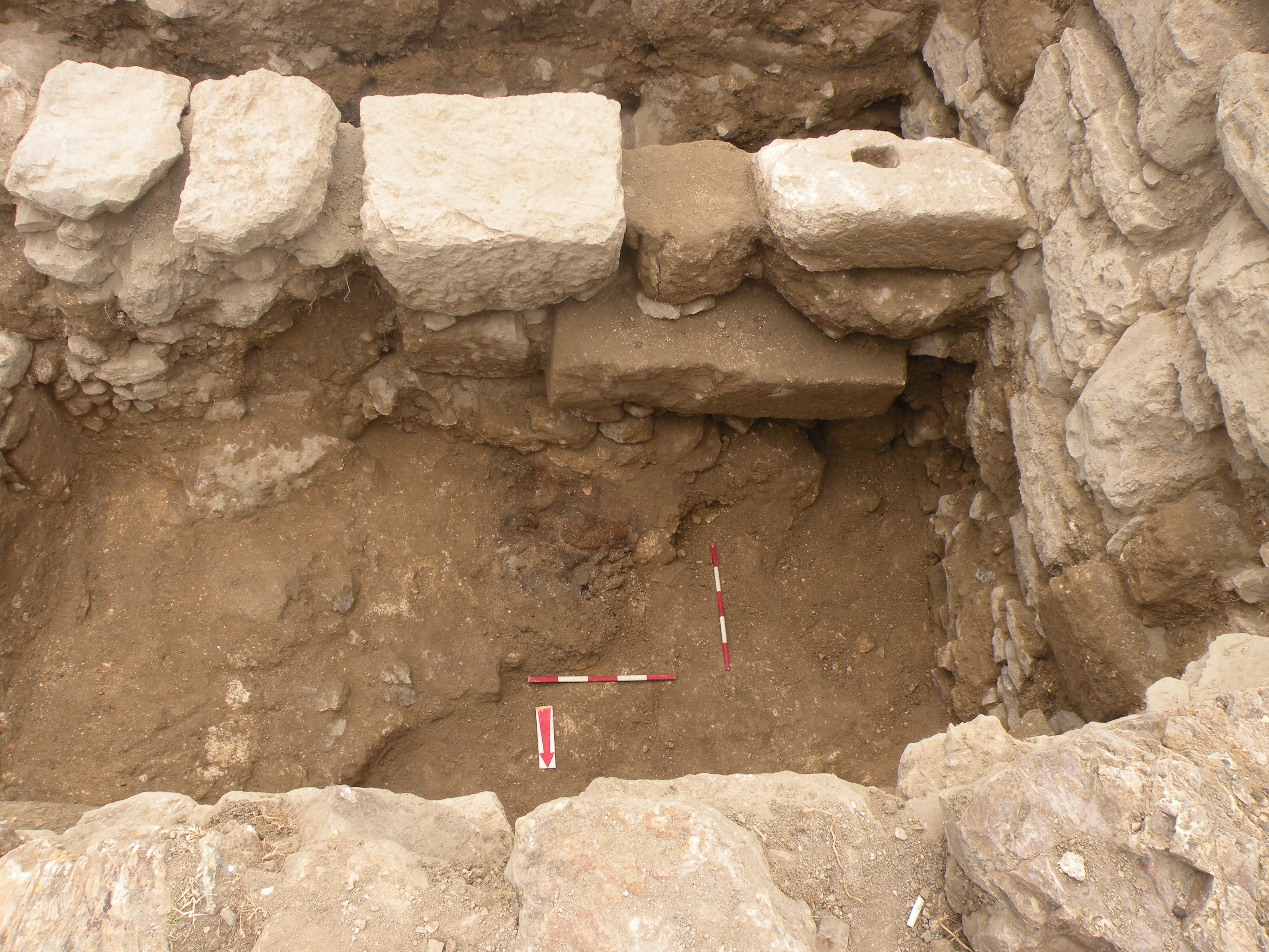
Below the Middle Islamic level, the continuation of a plain mosaic (a part of which had been discovered in 2023) was found (, ). Cleaning of debris at the western part of the Trench revealed a North-South wall constructed of medium-sized irregular stones directly above the debris of the earthquake (, ). This wall, in line with the western side of the Roman arch in Trench S-2 (2019), obviously pre-dated the construction of the barrel vault and post-dated the mid-8th century CE.
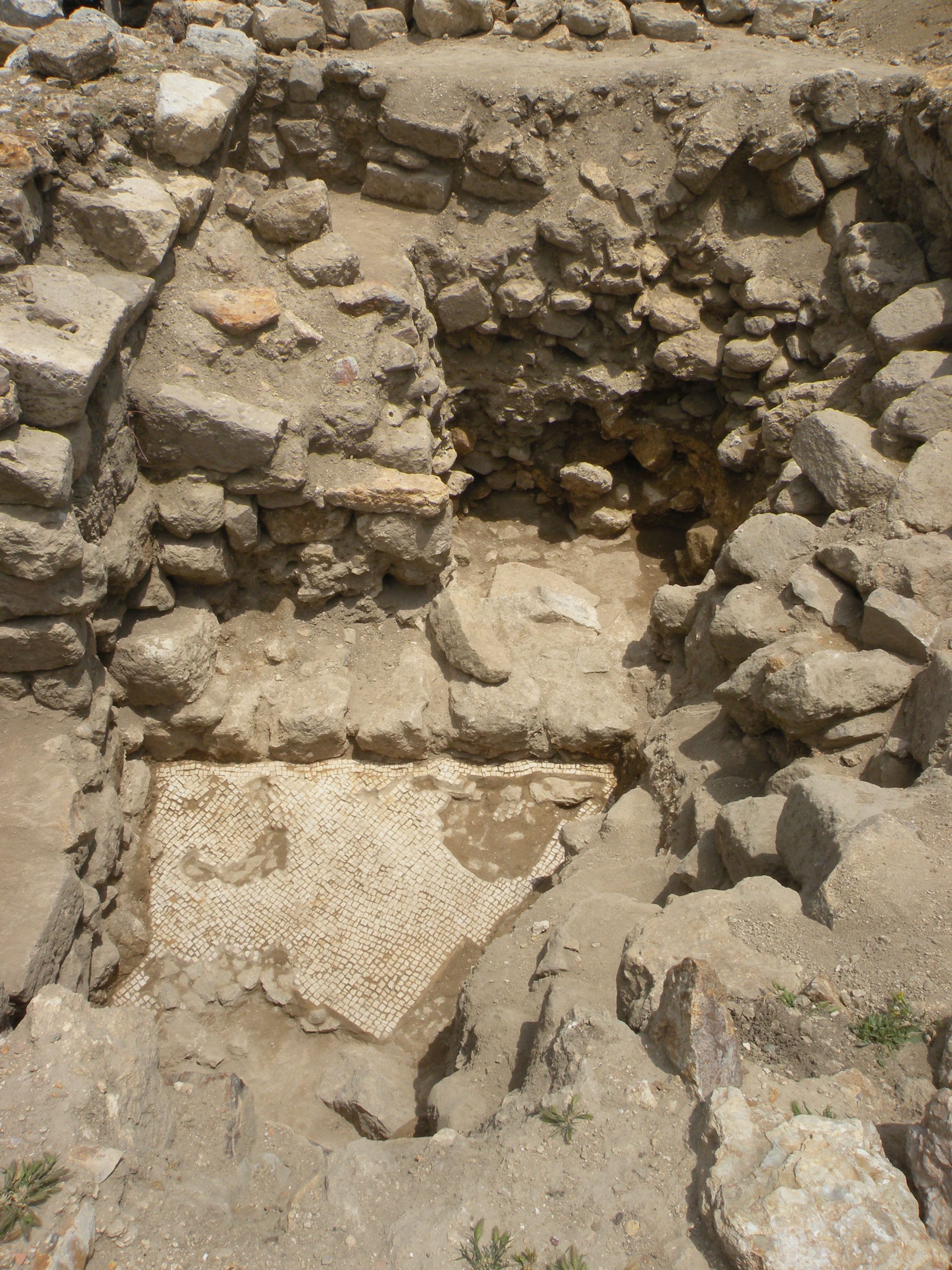
F059 with parts uncovered in 2024, abutting
wall W2-S/4 and continuing under wall W2-S/6
(left); view from the West (image by Mariusz
Burdajewicz).
background; view from the Southeast (image
by Mariusz Burdajewicz).
On the East, the mosaic abutted on an N-S wall about the same period; on the other side of the wall in question, a vast pithos was found in situ, broken into pieces apparently during an earthquake (). Also, the westernmost part of the mosaic floor had been destroyed doubtlessly during the same disaster, as evidenced by thick stone debris overlaying a recessed area. Most probably, the earthquake in question was caused by 749 CE, which would assign both the mosaic room and the pithos room to the Umayyad period. The exploration under the level of the broken pithos revealed the presence of a pavement, which most probably was a part of the original Roman foundation. The accumulation(?) of the material above it yielded Late Roman potsherds ( and ).
broken pithos in situ; view from the South (image by Mariusz
Burdajewicz).
period; view from the Southeast (image by Mariusz
Burdajewicz).
Wojtek Oubraham).
Trench T5
Trench T5 was a square opened in front of the Roman-period vestibule(?) on the eastern side of the "Ammonite tower," in the place where one would expect the presence of a staircase leading from the Roman-period courtyard up to the temple ( and ). However, no trace of any steps has been found.
(image by Jolanta Młynarczyk).
Młynarczyk).
Instead, the exploration yielded a series of Mamluk, Fatimid, and Ayyubid period () walls and floors. The earlier occupation phase was an Abbasid-period floor, associated with iron smelting activity, judged by the discovery of a metallurgical furnace (). The workshop can confidently be dated to the early Abbasid period by the pottery associated with its level as well as with the floor directly above it ().
Northeast (image by Mariusz Burdajewicz).
view from the West (image by Mariusz Burdajewicz).
This floor, alongside rectangular compartments of unspecified domestic function, rested upon an exceptionally thick layer of the destruction of a building constructed of ashlars (). This layer, almost devoid of pottery (a few Umayyad-period potsherds), contained relatively abundant ceramic building material (fragments of roof tiles, etc.), many ashlars (including those of a collapsed arch or pillar) and a molded cornice block (). The destruction layer abutted the deep foundation of the Roman period vestibule in the upper part of which two shafts (drums?) of small columns (c. 0.40m in diameter) had been reused (). The vestibule had been used as a wall of the ashlar house, with fragments of plaster still preserved in situ. A plain(?) mosaic floor comparable to that found in Trench 5 adjoining the vestibule wall. There is little doubt that this evidence of violent destruction relates to the same earthquake of 749 CE, which destroyed an Umayyad-period building in Trench 2-S.
with a fallen pillar and the monochrome mosaic floor below it;
view from the East (image by Mariusz Burdajewicz).

Umayyad-period debris (image by Mariusz Burdajewicz).
reused column shafts from an earlier period; view from the
East (image by Mariusz Burdajewicz).
To conclude, on Trench T5 (), against our initial supposition, no staircase leading to the “Ammonite tower” has been discovered. The only logical explanation is that the steps were dismantled and removed after the temple was disused, which would have happened in the Byzantine period. However, the vestibule foundation's depth remains to be discovered since it was reused as a wall of the Umayyad-period building, presumably a habitation.
Adel Wojtek Oubraham).
Concluding remarks for the 2024 season
While the site of Khirbat es-Sar remains anonymous, the field season of 2024 once again proved its great historical importance. For the first time, we have recorded a complete sequence of Islamic occupation phases from the Umayyad through the Abbasid, Fatimid, Ayyubid, and Mamluk periods, possibly reaching into the early Ottoman times. More difficulty has been detailed in distinguishing the pre-Islamic periods, although indications of the Byzantine, Roman, and Hellenistic phases are pretty eloquent. The site’s occupation during the Hellenistic period has been confirmed by finding both details of monumental architecture and ceramic fine wares, among them imports from local and western trading centers. Based on the pottery, the Hellenistic occupation is probably the second half of the 2nd century BCE. Although evidenced by architecture and pottery, the Roman period cannot be satisfactorily divided between the early Roman and late Roman phases. The same should be said about the transition from the late Roman/Byzantine to the early Islamic/Umayyad period.
Select pottery (images by Jolanta Młynarczyk):
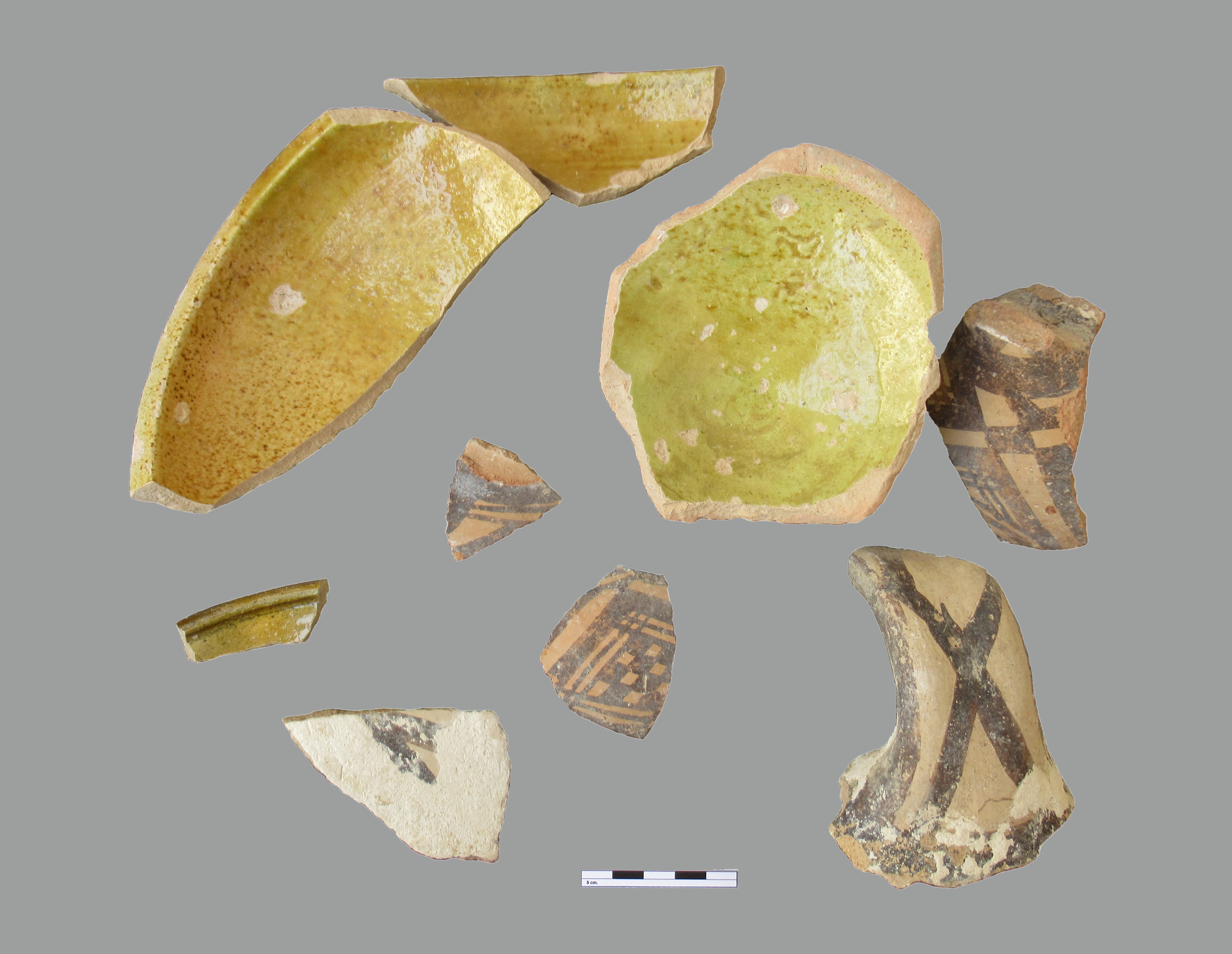
Fig. A 19. Trench 2-S: sample of pottery found on F053
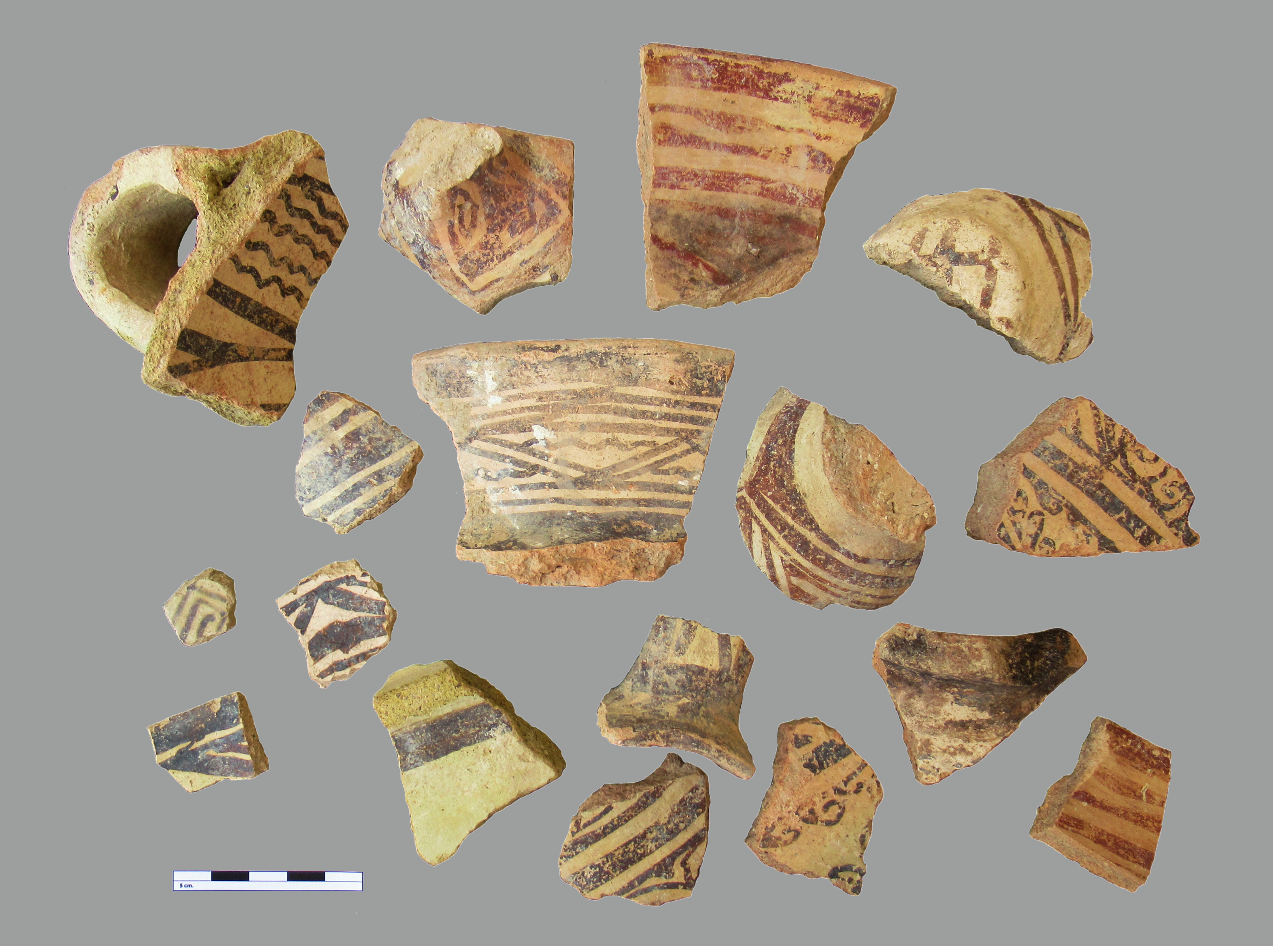
Fig. B 22. Trench 2-S: sample of Ayyubid pottery

Fig. C 30. Trench 2-S: sample of late Roman pottery
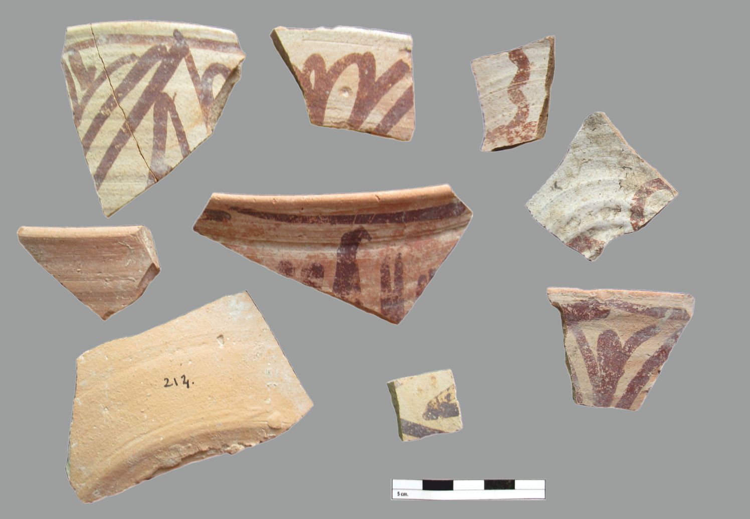
Fig. D 46. Trench 5: sample of early Abbasid-period pottery
Architectural survey
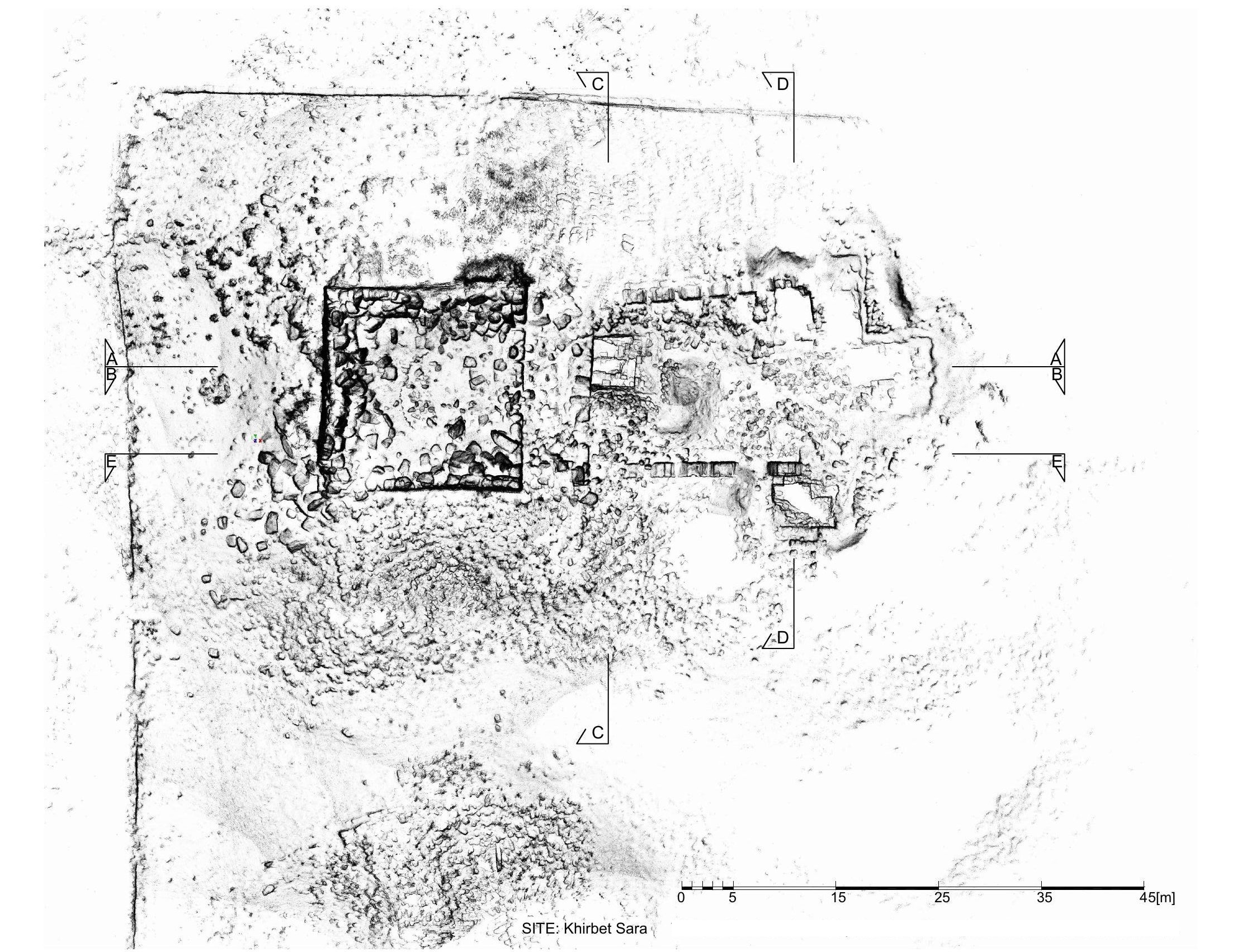
In addition to the excavations, during the field season, the architect of the mission (Dr. Anna Kubicka-Sowińska, Wroclaw University of Science and Technology) conducted an architectural survey in which the site area of Khirbet es Sar was captured using a 3D scanner Livox Mid-360. As the result of 80 scan positions, we obtained a 3D point cloud representing measurements from the "Ammonite tower," the Roman arcade, and the 40m surrounding area (). Architectural works were focused on measuring and analyzing architectural detail, which enriched the collection of stone decorations dated to the Roman period during the current archaeological survey. Ongoing archaeological measurements were captured on an ongoing basis, including the preparation of 3D documentation of this year's trenches.
Complementary geophysical survey
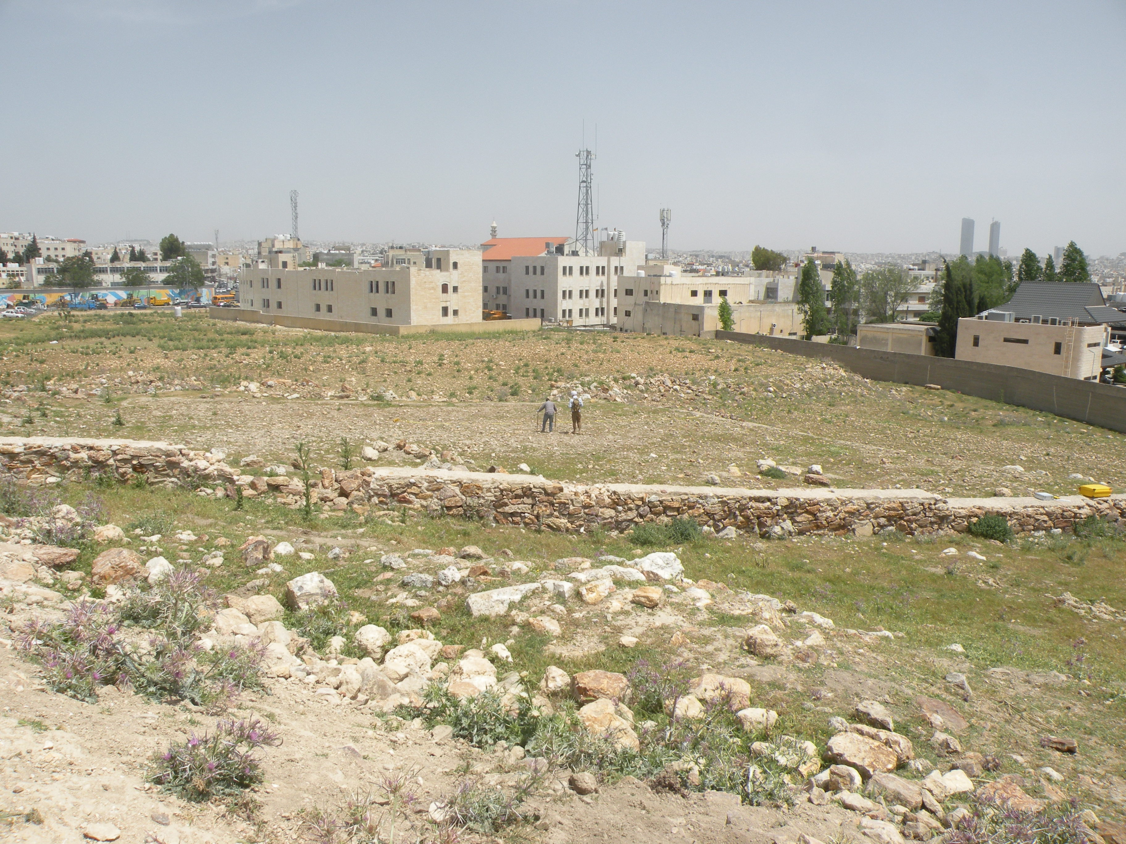
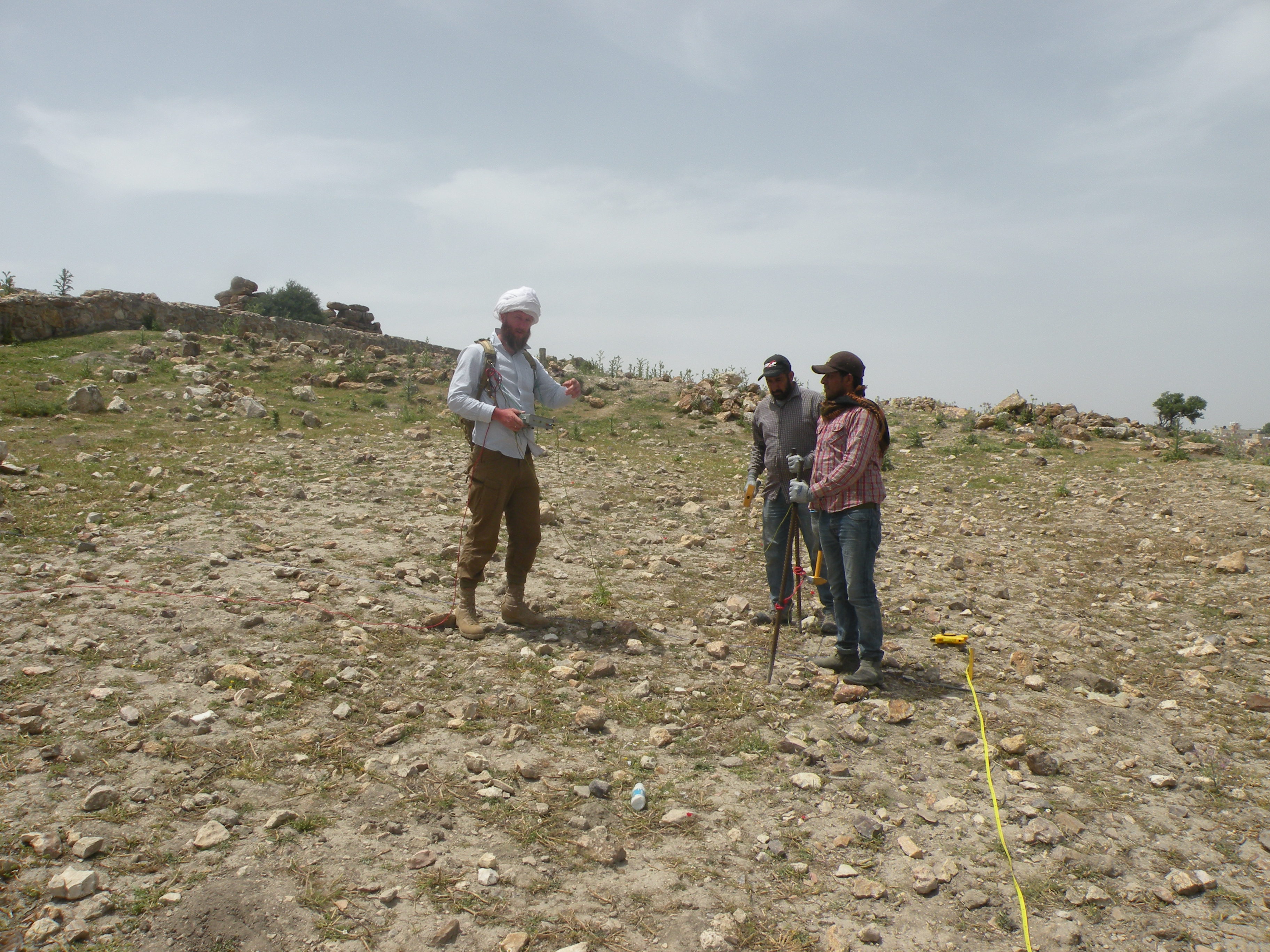
Also, during this season, Mr. Jakub Ordutowski conducted a geophysical survey (with the electrical resistivity method) on the part of the land right to the North of the ancient site fenced by the DoA (). This survey was complementary to the one by Robert Ryndziewicz (Institute of Archaeology and Ethnology, Polish Academy of Sciences) in March 2018.
As expected, the survey confirmed the presence of ancient architectural remains, albeit on the ground surface, they are not quite legible ( and ). Some architectural details can be observed in the construction of dry walls supporting pasture terraces. This observation corresponds with recorded anomalies of electrical resistance. The terraces strongly affected the relics of earlier architecture; nevertheless, high-resistance linear anomalies potentially reflect the remains of older phases of the settlement.
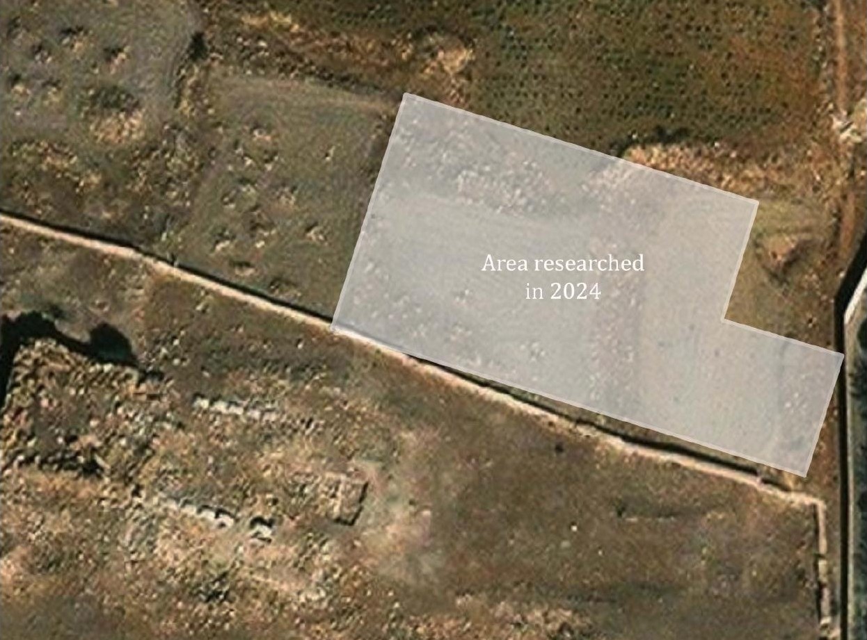
(image by Jakub Ordutowski).
Mariusz Burdajewicz).
Mariusz Burdajewicz).